

With Alistair Vaicle, Inès Masson and Sophie Jacquemin under m.at
Historically, Etterbeek and specifically the junction at the now place Jourdan of chaussée de Wavre and chaussée Saint-Pierre is one of the oldest suburbs of the historic city of brussels – appearing as far back as the 10th century – and very soon becoming an important leisure and promenade place for the inhabitants of the city.
The park itself by comparison is very recent, and appearing only at the very end of the 19th century for the world’s fair. Before then it was a maneuvering field on top of a plateau at the convergence of the maelbeek valley with one of its arms. The main axis on which the park is drawn - avenue de tervueren, only appearing for the construction of the park itself. The arches, acting as old city gates, were never used as such and are only decorative, as was a common gesture around the turn of the century.
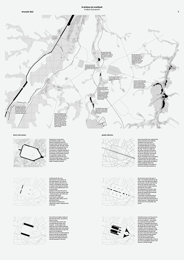
Etterbeek appears at the bottom of the maelbeek valley, next to the maelbeek stream itself. The maelbeek stream has the particularity of being one of the few geological characteristics of the city surroundings still very present today – even though it was almost completely covered. The valley itself still has a very real presence in the urban fabric of the city with the source of the stream in the la cambre abbey, followed by a series of ponds connecting the stream all the way to its outpour to the senne in schaerbeek. Some of the ponds still exist today, the most famous being the Ixelles ponds near the place flagey and the la cambre abbey, the Parc Léopold, the Square Marie-Louise - known as the St. Josse-Ten-Node pond before the covering of the stream, and the parc josaphat. These are all very present in each respective neighborhood today and, as an ensemble, offer probably one of the most remarkable historical and geological characteristics of the city itself.
The valley itself was prone to several floodings in heavy rain, the stream easily flooded onto the neighborhoods – and it was covered in 1872. even then, floods were a problem until the recent construction of storm basins in belliard and flagey.
The park’s position is particularly relevant in this context, overlooking the valley from the plateau on which it stands.
This then became the main proposal for this project – to turn the park into an immense natural retention basin, that will allow the water to permeate by itself, and in case of overflow, to canalize the excess water in storm basins to control and mitigate the flow of water towards the covered maelbeek stream.
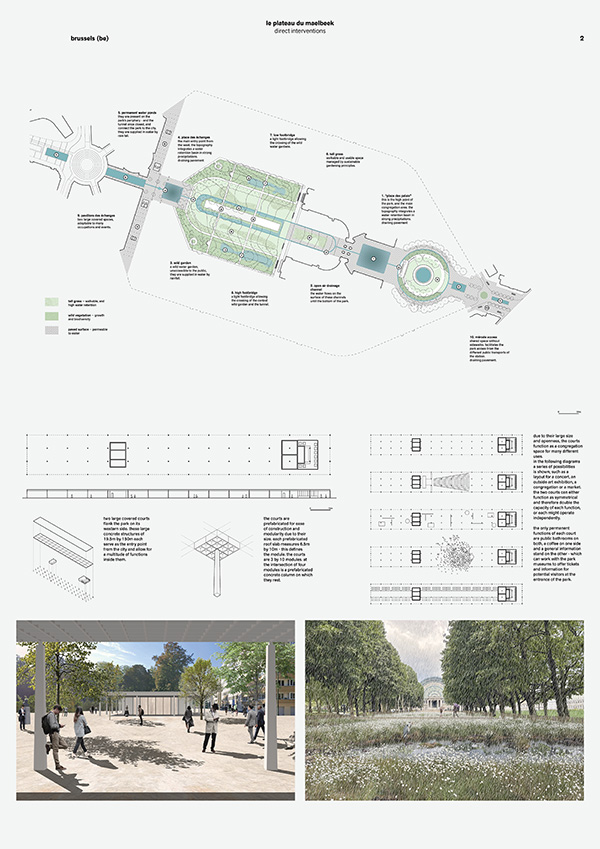
Architecturally and urbanistically, our proposal follows the main axis of the park for the big interventions, all the while proposing a series of punctuated interventions that will allow for a better and healthy usage of the park in the future.
The first, and biggest intervention, is the creating of several water retention ponds along the main axis of the park. This gesture directly reflects the natural purpose we are giving the park, in a very visible and poetic approach. the old decommissioned tunnel will also be used as an underground storm retention basin in cases of extreme precipitation. Two small pedestrian bridges follow the axes of the existing foot paths to allow an easier crossing of the park on its south-north route.
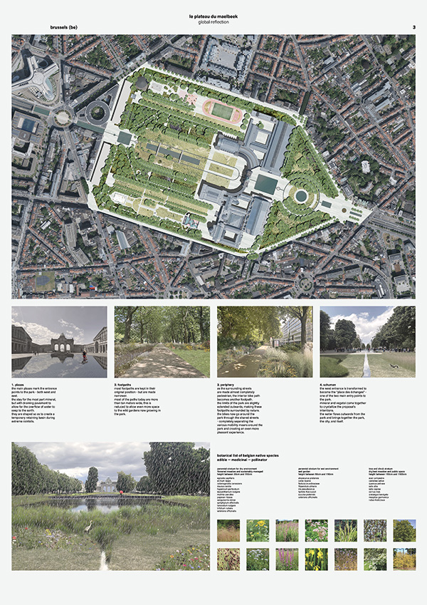
The proposal then rethinks the vegetation of the park by replanting most of the grass areas with natural tall growing grass and allowing for the formation of natural ponds in case of heavy rain for water retention. By giving the park a natural function, we redefine its role in the neighborhood and emphasize its naturality – which is somewhat lost in the current configuration.
these interventions, together, will redefine the totality of the park and yet still maintain its strong identity. By projecting ourselves into an inevitable future, we defined a clear guiding principle for all future interventions in the park all the while bringing nature and biodiversity back to such a large area within the city limits.
The geological approach of our proposal is what gave it its name – plateau du maelbeek. To redefine an area as it was before human intervention and therefore rename it to its natural condition.